50.8, 4.93333


La Carte Narrative de Tirlemont - "Hun Tienen" (Belgium)
Tirlemont
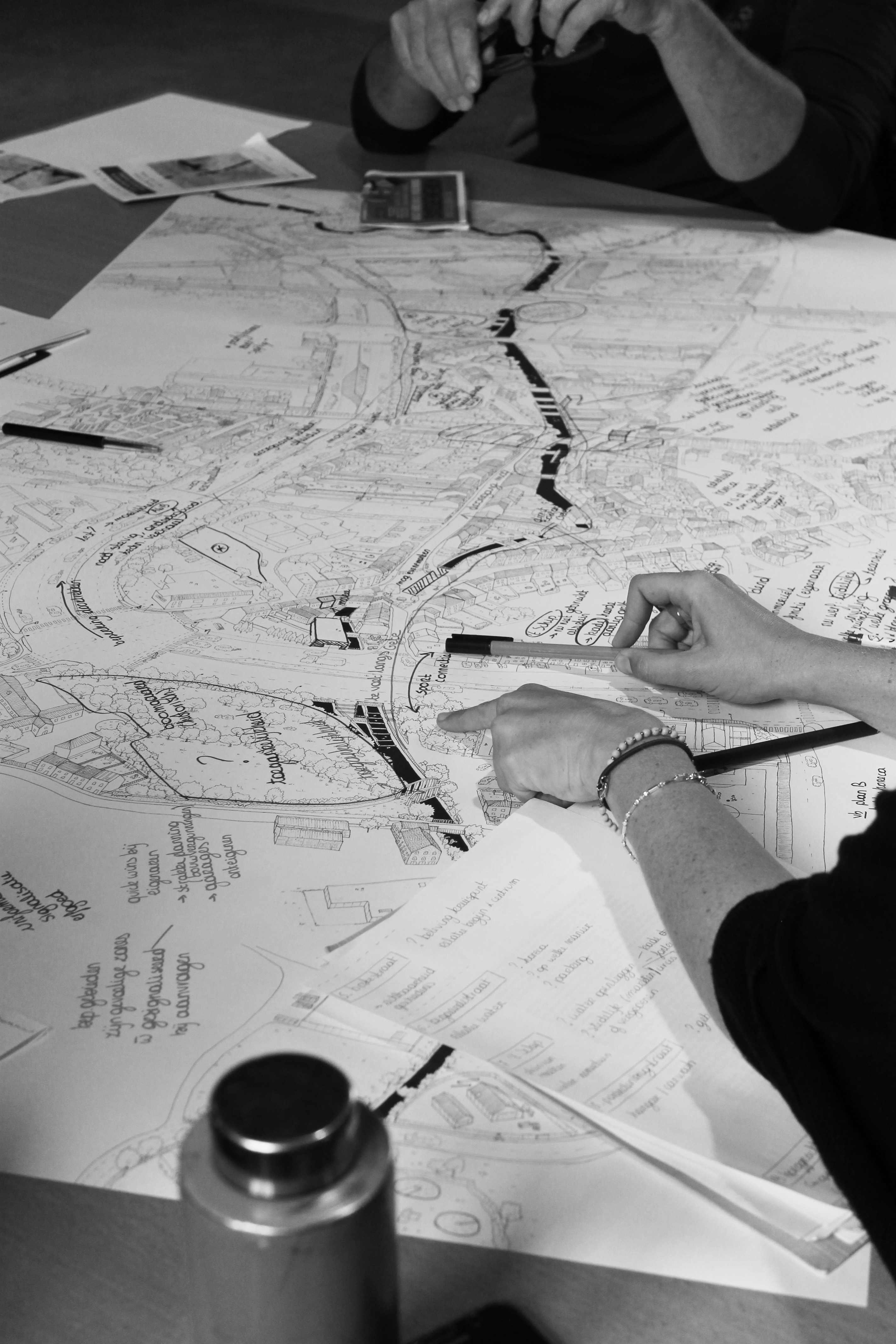
This artwork is a narrative map as part of a participatory process around the redevelopment project of the surroundings of the Gette in the city of Tienen, in Belgium. This map has been created between October 2018 and October 2019. Different steps have been necessary to create it :
- Urban, cartographic and historical research
- Walks along the Gette: getting to know the place and the inhabitants
- Workshop with local residents: analyze the site, strengths, weaknesses
- Illustration of a map that transcribes the research and the content of the walks and the workshop
- Workshop around the final map: analyze reactions, generate ideas for the project.
Les ‘Cartes Narratives’ are hand-illustrated cards that tell stories about a place - a street, a neighborhood, a city - for a day, a week or a year. They are illustrated in the form of axonometric plans with proportions and scales open to interpretation, revealing characteristics, key places, anecdotes, atmospheres and the identity of a place. They reflect the personal feelings and the own experiences of the illustrator, residents and individuals, and allow encounters, spaces and stories to be remembered. Les Cartes Narratives are a tool for communication, discussion and reflection on a territory. In particular, they make it possible to establish a link between residents and project leaders or designers. They link the different areas of expertise of the illustrator, namely, land use planning, the development of a participatory process and illustration by hand.
Link to an external source of the artwork: https://www.lescartesnarratives.com/flandre